Mount Tai: Choosing a Route, Catching Sunrise and Sleeping on Top
Mount Tai rises 1,545 metres above the Shandong plain, a modest figure that has never been the point. What matters is the 6,300 stone steps cut into its southern face, the inscriptions carved beside them over two thousand years, and the fact that this is the mountain where Chinese emperors went to report to heaven. The climb is hard. Planning it is harder.
This guide is about the visit rather than the journey. It compares the three ways up, explains what sunrise and the cloud sea are actually like, and sets out a two-day plan that leaves time for the temples. For trains, stations and the step-by-step logistics of reaching Tai'an, read the companion Mount Tai transport and climbing guide; this piece starts at the gate.
Mount Tai at a glance
| Location | Tai'an, Shandong, on the Beijing–Shanghai high-speed line |
|---|---|
| Height | 1,545 m at Jade Emperor Summit |
| UNESCO status | World Cultural and Natural Heritage since 1987 |
| The climb | About 6,300 stone steps, 7.5 km from Hongmen |
| Main entrances | Hongmen in the city, Tianwai village for buses, Taohuayu in the west |
| Summit landmarks | Nantianmen, Bixia Temple, Jade Emperor Summit, Riguan Peak |
| Best months | April–May and September–October |
| Suggested stay | One night on the summit |
Three routes, three different days
Maps draw a single line up the mountain. You decide where to join it, and that decision shapes the whole day: how much you walk, which inscriptions you see, and how fresh you are at dawn.
| Route | Where it starts | Walking time | Extra cost | Best for |
|---|---|---|---|---|
| Hongmen (Red Gate) | Town centre | 4–6 hours up, 3–4 down | None | The full climb, temples and inscriptions |
| Zhongtianmen (Middle Heaven Gate) | Tianwai village, by shuttle | 2.5–3 hours up | About ¥30 | Fit walkers with limited time; the best balance |
| Nantianmen (South Heaven Gate) | Zhongtianmen, by cable car | 20–30 minutes | About ¥130 | Bad knees, small children, tight schedules |
| Taohuayu (Peach Blossom Valley) | Western entrance | 3–4 hours up | About ¥130 | Public holidays and spring flowers |
Hongmen: the whole staircase
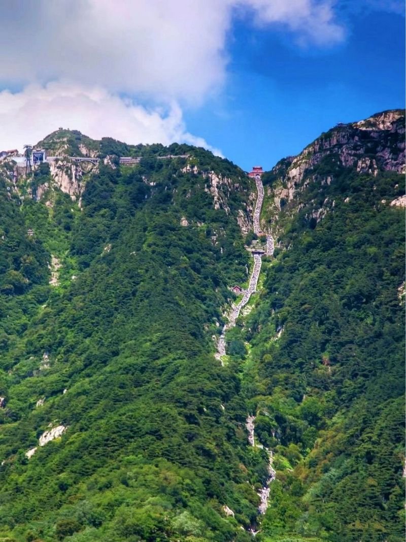
Hongmen, the red gate, stands in the middle of Tai'an, so the climb begins at street level. The path passes Doumu Palace and Red Gate Palace, crosses stone bridges, and keeps climbing through pine and cypress before the Eighteen Bends, the final kilometre where the staircase seems to continue past the skyline. Allow four to six hours. Shops every few hundred metres sell water, instant noodles and coat hire, so carry very little.
Zhongtianmen: the half climb
A shuttle from Tianwai village reaches Zhongtianmen at about 847 metres in around half an hour. From there you walk the upper half: 2.5 to 3 hours, the best views, and nearly all the famous gates. This is the route for people who want to have climbed Mount Tai without giving the mountain an entire day. It is also what most Chinese families do, so it is busy by mid-morning. Start at opening.
Nantianmen: the summit, delivered
The cable car from Zhongtianmen reaches the top station just below Nantianmen, the South Heaven Gate, at roughly 1,460 metres. From there it is a 20 to 30-minute walk through the gate, past Bixia Temple, to the hotels and the summit ridge. There is no shame in this; emperors were carried up on sedan chairs.
On public holidays, consider Taohuayu on the west side. It has its own shuttle and cable car, a fraction of the traffic, and in April the valley below is the prettiest part of the mountain.
Sunrise, the cloud sea and the odds
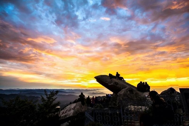
Sunrise happens at Riguan Peak, ten minutes east of the summit hotels. In June it arrives before 5 am; in December, after 7. Check the time for your date rather than trusting a guide written in another season. Get there 30 to 40 minutes early at weekends, when the front row fills with people who climbed overnight and are now asleep on their feet.
The cloud sea is weather, not an attraction. It forms when moisture is trapped below the summit, usually after rain and most often in autumn and early winter, and it can appear or vanish within twenty minutes. A clear forecast gives you a clear dawn, not clouds beneath you. If the morning is a white-out, walk the ridge instead: the inscriptions around Jade Emperor Summit and the drop of the north face are reason enough to be up there.
Sleeping on the summit
Where you sleep decides what kind of sunrise you get. There are three options, and none of them is luxurious.
- Summit hotels and dormitories near Nantianmen and along the ridge. Expect simple rooms, thin walls and shared or private bathrooms. A dormitory bed starts around ¥200; a room in high season runs about ¥600–1,200. Book weeks ahead for October weekends.
- Guesthouses at Zhongtianmen, halfway up. Cheaper and quieter, but you start the upper climb at 3 am.
- The night climb from the city, which is free and popular with students. The path is lit and safe, but you reach the top cold, tired and in a crowd.
The summit is 1,545 metres and completely exposed. Even in August the wind at 4 am goes through a T-shirt; in winter, without a real jacket, it is dangerous rather than merely uncomfortable. Hotels rent padded coats, and the small fee is worth paying.
Dai Temple, before you climb
See Dai Temple first. It sits at the foot of the mountain, costs about ¥20–30, and was the ceremonial start of the imperial Fengshan sacrifices. The main hall borrows its proportions from the Forbidden City, the steles in the courtyard record three thousand years of people climbing this mountain, and one to two hours here changes how the staircase above feels. Go in the morning, leave your bag at the hotel, then start walking.
Tickets and costs
| Item | Approximate price |
|---|---|
| Admission, March–November | About ¥115 |
| Admission, December–February | About ¥100 |
| Dai Temple | About ¥20–30 |
| Shuttle to Zhongtianmen | About ¥30 |
| Cable car, either line | About ¥100 |
| Summit dormitory bed | From about ¥200 |
| Summit room, high season | About ¥600–1,200 |
These are planning figures for 2026 and they change with season, policy and demand, so confirm at the gate or on the official mini-program. Foreign cards often fail in Chinese mini-programs: set up Alipay or WeChat Pay before you travel, and keep a few hundred yuan in cash for the stalls on the steps.
Seasons and the crowd calendar
| Season | What you get | What to expect |
|---|---|---|
| April–May | Mild air, blossom, clear ridges | Busy weekends; May Day is the worst week of spring |
| June–August | Long days, green slopes, warm nights | Heat on the lower steps, afternoon storms |
| September–October | The clearest skies and best sunrise odds | The first week of October is the busiest of the year |
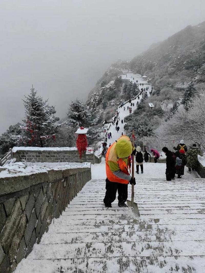
| December–February | Snow, empty temples, hard winter light | Ice on the upper steps; cable car can close in wind |
The crowd calendar matters more than the weather. Avoid the first week of October, the May Day holiday and Lunar New Year, and choose a weekday if you can. A Saturday in April is busier than a Tuesday in November by a wide margin. Winter is quiet, cheap and photogenic, provided your shoes have grip and your coat is a real one.
A two-day plan that works
- Day 1, morning: Dai Temple, then an early lunch in the city.
- Day 1, early afternoon: shuttle to Zhongtianmen, walk up through the gates to Nantianmen, check in, and catch sunset from Jade Emperor Summit.
- Day 1, evening: eat at the summit, set two alarms, sleep.
- Day 2, before dawn: Riguan Peak for sunrise, then Bixia Temple and breakfast.
- Day 2, late morning: descend on foot through the Eighteen Bends to Hongmen, about three to four hours, or take the cable car and shuttle if your knees have had enough.
With only one day, go up by shuttle to Zhongtianmen, walk the upper half, and come down by cable car. You will miss most of the inscriptions and all of the night, but you will still have stood on the summit.
Things that go wrong
- Starting at midday in summer. The lower steps have no shade and no wind.
- Underestimating the descent. Going down 6,300 steps is harder on the knees than going up; poles help, and the cable car is not a defeat.
- Packing for the city. The summit runs five to eight degrees colder than Tai'an, with wind on top of that.
- Trusting a guaranteed sunrise. No forecast sells that, and no hotel can arrange it.
- Carrying too much. Water, noodles, fruit and coat hire are available the whole way up, at a price.
Where to go next
If sunrise is the reason for the trip, read about Bixia Temple at the summit and Mount Tai in autumn, when the odds of a clear dawn are best. Mount Tai in winter describes the snow and ice version of the same climb. For the wider picture, see the most beautiful mountains in China and the best hiking trails in China.
Frequently asked questions
Can you see sunrise on Mount Tai without sleeping on the summit?
Yes, by starting from the city around 9 or 10 pm and reaching the top before dawn. The path is lit and shops stay open all night, but you arrive cold and tired. A summit dormitory bed, from about ¥200, is the more comfortable version.
Which route up Mount Tai is the easiest?
The Nantianmen route. A shuttle to Zhongtianmen costs about ¥30 and the cable car about ¥100, leaving a 20 to 30-minute walk to the summit. The Zhongtianmen half-climb, roughly 3 hours of steps, is the best middle option.
How much does a night on Mount Tai cost?
A dormitory bed starts around ¥200, while a room in high season runs about ¥600 to ¥1,200. October weekends and the May Day holiday are the most expensive and sell out weeks ahead. Prices change, so confirm directly with the hotel.
Is the cloud sea at Mount Tai guaranteed?
No. It forms when moisture is trapped below the summit, most often after rain in autumn and early winter, and it can dissolve in twenty minutes. A clear forecast gives you clear skies, not clouds beneath you. Plan two mornings if the cloud sea is your main reason for going.
How fit do you need to be for the 6,300 steps?
Reasonably fit is enough: 4 to 6 hours up and 3 to 4 hours down, with shops and benches the whole way. The descent is harder on the knees than the ascent. If that sounds like too much, use the shuttle and the cable car.
Do you need a guide for Mount Tai?
No. Signage is partly in English and the main route is impossible to lose. A guide adds context at the temples and inscriptions, but the mountain itself is straightforward. Download Amap and carry your passport.
Keep reading
Mountains
Tianchi Lake at Changbai Mountain: When the Crater Lake Appears
Tianchi — Heaven Lake — is the reason people fly to Changbai Mountain: a crater lake at about 2,190 m inside a …
Mountains
Hidden Mountains in China: 10 Peaks That Western Itineraries Skip
The mountains foreign visitors skip are not secret. Chinese hikers know them, photograph them and queue for …

Mountains
10 Most Beautiful Mountains in China, Ranked
If you have time for exactly one mountain in China, make it Huangshan. If you have two weeks, the ten below …